
John Rocque’s Berkshire Map, 1761
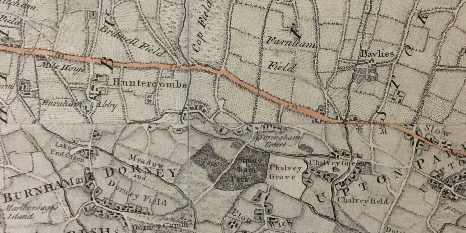
John Rocque’s ‘A topographical map of the county of Berkshire’ was first published in 1761. It could well be the earliest map in existence that shows Cippenham, which Rocque spelt ‘Sypingham’. The map was produced in 18 plates and unfortunately Cippenham is located between the boundaries of four separate plates. The sheets do not align that well with each other and the sharpness of the lower plates is not as good as the two upper plates. The image shown below is from one of two imprints held by the National Archives. The map gives a very detailed view of Cippenham in the mid-18th Century and there are many interesting features.
A number of today’s roads are easily recognisable including The Bath Road (coloured), Cippenham Lane, Spring, Elmshot and Lower Cippenham Lane. The course of the roads shown on the map probably weren’t that accurate. Cippenham buildings on the map that still exist today include Cippenham Place and the barns of Cippenham Court Farm.
A section of John Rocque’s map of Berkshire, 1761
Wood Lane runs through the middle of a forest which is annotated Sypingham Park. This was once a royal hunting park created by Richard, Earl of Cornwall in the 12th C. There is possibly an indication of the site of the royal palace as there seems to be a clearing in the forest of about the right size and placement.
Two-Mile Brook and the village green are clearly discernible. The greatest concentration of dwellings appears to be on the north side of Lower Cippenham Lane past the east of the green.
Ay Mill doesn’t appear on the map – for some reason Rocque did not include ‘industrial’ buildings. A windmill can, however, be seen at Salt Hill which may well have been built on top of the Montem Mount.


Leave a Reply