
Comparing Old Cippenham with The Present Day
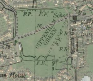
The National Library of Scotland has created a superb online resource for making comparisons between historic Ordnance Survey maps and Esri satellite images. The image below has been created using this resource to compare the 1897 OS map with the present day. The transparency of the overlaid image can be changed by clicking the left and right arrows.


It can be seen how much the village pond has shrunk since 1897.
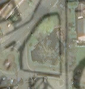
On the other hand the village green has grown a little.
You can try this out yourself by following this link. Look out for the slider which controls the transparency overlay (normally at the bottom of the search panel). This resource doesn’t only work for Cippenham but for the whole country – even Scotland!


Images reproduced with the permission of the National Library of Scotland
Map Images Website https://maps.nls.uk/index.html
I got a map from Slough Museum (cheap, they were selling them off!) years ago which showed all the field names that dad knew, I gave it to the family historians, aunt Joan and uncle Ken (Kennedy) dunno what happened to it, they’re dead now and I’ve been unable to find another copy and no-one knows what I’m talking about! Can anyone help?
Hello Dave, I think the map you mention was created by Michael Bailey who died a couple of years ago. He was related to the Headington Family of Cippenham Court Farm and was very knowledgeable about Cippenham. He gave me a copy of his map of the old field names (along with three others he had drawn). I’m pretty sure I can find it in which case I will arrange to have a copy sent to you.
I am fascinated by these ‘then & now’ maps, but cannot see the link to access them