
Two-Mile Brook
Two-mile brook is an ancient mill stream that flows from Haymill (once the site of a mill called Ay Mill) through the heart of Cippenham. It possesses more early historical references than any building or other feature within Cippenham. The brook was gifted to Burnham Abbey by its founder, Richard, King of the Romans and brother of Henry III of England. Although the foundation charter from 1266 confers rights over milling and watercourses, these were were in connection with land that had been acquired from one John de Boveneye. This land is known to have actually been in Boveney which contained another mill. In 1268, Richard confirmed the charter of 1266 and in addition gifted:
“the mill of Ayemale with the mill-dam and fish-pond and adjacent pasture about the mill dam, as contained by the metes and bounds set up by the grantor himself on the east side of the dam; gift also the water-course of the said mill-dam from the said mill through the manor of Sipenham and thence to the said monastery as the grantor himself had the said watercourse made; to be held by the said monastery and nuns in frank almoin”
The stream flows into other watercourses which finally connect with the Thames at Eton Wick and Eton.
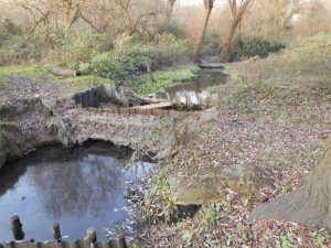
The steam flowing through the old mill-pond basin.
The source of the brook is a spring which emerges close to Whittaker Road and then flows 700m due south to the site where the mill once stood. The surviving mill-pond basin today is part of the Millie nature reserve and is the only remnant of milling on the site, the building itself having been demolished in 1960. The mill stood on the site now occupied by the petrol station on Burnham Lane. From leaving the pond basin to arriving at Cippenham village green the brook follows the same course as it did in the 13th Century.
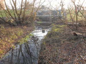
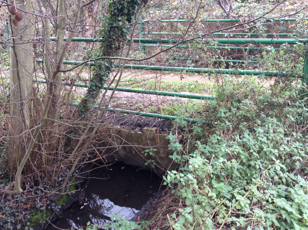
The stream goes underground where it leaves the Millie passing through a large metal and concrete structure set into the old mill dam
Today, however, it runs underground all the way to Cippenham village green. After departing the Millie, the stream crosses under Burnham Lane and the Railway embankment. It runs alongside Brook Path for a distance of 600 metres. This Brook Path section of the stream was the last to be put underground and the work was carried out in the late 1970s. Before then, at the place where the Bath Road crosses Brook Path there used to be a circular hole in a brick wall on the north side of the Bath Road which had been put there to enable steam wagons of the early 20th C to pass a pipe down to the stream to replenish the water for their boilers. Steam powered road vehicles had a remarkably long period of usage having first begun to appear in the late 1850s. Finding suitable sources of water replenishment was often a troublesome issue for the operators and it was probably a welcome site when the White Horse inn on the opposite side of the road came into view. Sadly the inn was demolished in the 1990s to make room for a car-sales compound.
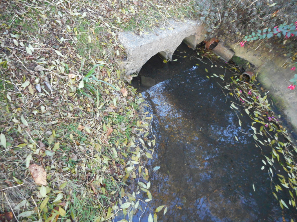
The millstream emerges from underground near the village green
The stream continues underground until roughly adjacent to the front of the British Legion building in Brook Path. It then veers off in the direction of the village green passing under Bowyer Drive and back gardens on Lower Cippenham Lane. Just before reaching the green it crosses under Lower Cippenham Lane and finally emerges into daylight. The brook then turns left to flow along Millstream lane on the east side of the green. The stream flows past the front gardens of a number of beautiful Victorian cottages and terraced houses. The little bridges joining each house with the road give the lane a unique quaintness. It provides one tiny glimpse of what a picturesque place Cippenham Village was a hundred years ago.
In the 1268 grant of Ay mill, above, it is recorded that Richard had by that time diverted the watercourse from Cippenham Manor to Burnham Abbey. According to A History of the County of Buckingham, 1925, (HCB) Burnham Abbey’s right to divert the water from Cippenham manor was legally challenged question in 1276. Richard’s son Edmund Earl of Cornwall, however, “confirmed to the abbey the mill and watercourse so fully that no diversion could be made to Cippenham Manor or elsewhere, with power at any time to stop the course of the water which used to flow to Cippenham manor and to close all the breaks at will. This concession, though ratified by Edward III in 1328 didn’t protect the abbess from citation before Cippenham Court in 1395 for obstructing the water in two-mile brook at ‘le Park Burne’ and for allowing it to overflow the lands of tenants”.
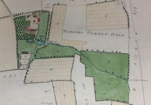
Cippenham Village Green, 1841
Although it is evident that a diversion must have existed from two-mile brook which went to Burnham Abbey, in the present day, Cippenham green is the closest that the brook gets to the site of Burnham Abbey before it turns towards Chalvey. The diversionary spur can be seen on old maps, such as the one opposite, from 1841. This shows watercourses in blue and is much clearer than the contemporary Ordnance Survey map. It can be seen that where the stream meets Cippenham Green it forks. One fork takes the current route while the other skirts the green, then travels along what is now Mercian Way in the direction of Burnham Abbey.
Control of the flow of water as exerted by the abbess would probably have been via breaks (sluice gates) positioned where the stream forks. In fact, there was a single sluice gate on the green in far later times (until at least until the 1930s) that was used to stop the water flowing in the Burnham Abbey direction. By then the stream probably no longer went all the way to Burnham Abbey. In the winter during the early 20th C, the sluice was sometimes opened permitting the ditch on the north side of the green to flood. Once the water had frozen it was used by the local children for skating. The ditch on the north side of the green survived at least until the end of the 1970s.
HCB relates an interesting tale concerning the mill brook in the 16th century. Ay Mill was leased by one John Lidgold from Paul Wentworth in 1565. It was the miller’s duty to scour the brook leading to the Thames from the mill-pond to the sluice in the Cowley and from the Weedrake at Lake End Green down to the river. The miller neglected his task and Wentworth’s house was “not kept sweet and clean from annoyance of foul water”. A presentment for neglect was made at Cippenham Court and after a final warning on 11 November 1583 Wentworth turned the miller, his wife and five children out. It is noteworthy that the Miller’s duty was to the Burnham Abbey route of the brook rather than the Cippenham route to the Thames, suggesting that at this time the abbey route was the more important. The map section opposite showing Burnham Abbey is from 1804. It appears that the spur of the brook running to the abbey comes to an abrupt end there. Burnham Abbey may have been actually been a source for the brook, as implied by the ‘to Cippenham’ label. To the east, there was a south-flowing tee connecting with the Roundmoor Ditch which flows to the Thames.
Section of map of Burnham Abbey and surrounds, 1804.
To say that the Cippenham brook flowed to Burnham Abbey does not give quite the correct picture. The above section of map showing Burnham Abbey from 1804 shows a brook which originates from a spring next to the abbey. The spring and brook are still there today. The brook emerges from a tunnel on the east side of Huntercombe lane and after a few feet flows under a bridge in the adjacent field.
Close to the water spring at Burnham Abbey
The photo below shows the brook where it exits the bridge. This brook flows down into the Roundmoor Ditch. Once, the diversion from Two-mile brook joined with this brook at a point very close to the end of today’s Mercian way. Thus, the diversion created by Earl Richard would have followed the route of the present day Mercian Way and been 775 metres long assuming that the ‘moat’ around Cippenham green existed at this the time.
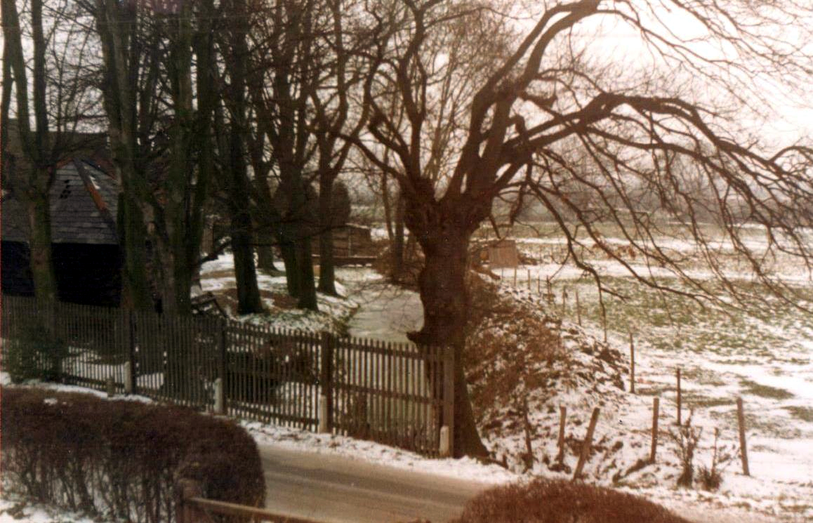
Lower Cippenham Lane
After leaving the village green the stream continues south for 150m entering the Windsor Meadows housing estate. It turns sharply to the east, and after 480m it is joined by a spur which flows south from the moat of Cippenham Place. The source of water for the moat is a spring, now placed underground, which is near the top of (the aptly named) Spring Lane. The brook continues east to cross Wood Lane close to the earthworks associated with the legend of a royal palace. On the far side of Tuns Lane it flows into Chalvey Ditch stream makes its way to the Thames at Eton Wick. This journey from Haymill to Chalvey ditch is indeed just over two miles.


My (elder) bro was always a daredevil, him & his mates used to wade up brook beneath railway line and climb into Rogers Mill by climbing up waterwheel (so he said) uncle Phil was manager at Hartwells and later managed Haymill motors which replaced Mill, the old wheel stood in Gregory’s field, behind the green for ages, my aunt Joan and uncle Ken (Kennedy) were trying to get it restored, dunno what happened, they’re dead now.
A branch of 2 mile brook started at top of Spring Lane in a round concrete cress bed below the Budds house, he was Headington’s farm manager, it amazed me they built house on top of spring!
I lived at the mill many happy times spent playing inside the mill while my father was doing the milling with mr. Rogers. We moved away in1960 a very sad time for us all. I had a wonderful childhood there and my memories will stay with me forever. I then was Pat Willingale now Pat James.
Hi Pat, I am doing a school project on the Hay Mill and have come across your comment. Wow how fascinating that you used to live and play there! I really like the Millie and have been helping to clear it up. Can you tell me anything more about the mill please?
Thank you
Aaron
According to the 1881 census, my 3x great grandfather Henry Francis Hone was publican at The White Horse, Two Mile Brook in 1881. Nine years later the family immigrated to Vancouver, Canada.
https://imagebin.ca/v/4HBmgBPB6c34
Does anyone know when The White Horse was torn down?
Are there any photos of The White Horse available whatever (given the date, it would be no surprise if there are no photos of The White Horse from 1881).
Thank you for your interesting comment. I have added some pictures of the White Horse (link below). It’s a shame that so little is known of the history of the inn and that there are no earlier pictures. I’ll keep my eyes peeled for a snap from 1881.
White Horse Pictures
I believe the White Horse Inn was demolished around 2003 to make way for Trade Sales car parking.
Thanks for posting those pictures. You might also be interested to know that there was a court case surrounding the proprietorship of The White Horse.
https://imagebin.ca/v/4WMEv2Kw6jMf
The article has a typo (HONE not HINE).
I said in my comment 4 years ago (was it really that long?) that uncle Phil was manager at Hartwells garage by the White Horse (he musta given my bro a job about 1954) Anyway I remember hanging up in the garage was an aluminium sign of the type fitted to cars that competed in the Monte Carlo Rally about 1953(?), I wondered what happened to it?
Bing is a useless search engine, I can’t even find out who Hartwell was!
This stream flows behind many cippenham homes. When considering a place to live does it pose any threat to health and safety for e.g. Gladstone way area?
We have lived in Gladstone Way since it was built in 1984 and have never been flooded from the two mile brook,which we own since the council let the builders include it in the length of our garden.
Hi I lived in cippenham all my life and have seen the changes since I was born, I can e en describe Elmshott lane and my Father worked out I was one year old then and can remember being pushed in the pram. Now am seventy two..St Andrews Church was a round oval thing grey, not a church these days.. Also the white horse was a listed building and stages coaches stoped there but it had changed over time and deliberately demolished was annoyed about that! They wreck most these day! Cippenham pond was going to be filled in and made into a car park eh! The pond was flat as a kid! With pond life and sticklebacks!
[…] Lane brook (traditionally know as Two-Mile Brook) was the main path (via the Hay Mill, demolished 1961) by which the water that wells up in Lammas […]